


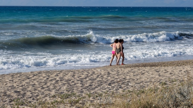
Warm weather accompanied by meltemia winds will continue through Sunday, maintaining consistent temperatures. Upcoming days are expected to remain summery, as highlighted by Klearchos Marousakis in a recent post.
The OPEN meteorologist also presented a map displaying the distinctions between cold and warm air masses, along with expected weather patterns for Greece.
“When the meltemia winds in the Aegean strengthen, thermal instability diminishes. Conversely, when they weaken, thermal instability increases in mountainous and surrounding areas. Based on our current atmospheric analysis, we anticipate a classic Greek summer in the coming days,” he explained.
High Fire Risk Today in 10 Regions
A high fire risk (category 3) has been forecasted for various parts of the country, according to the Fire Risk Forecast Map released by the General Secretariat for Civil Protection of the Ministry of Climate Crisis & Civil Protection (civilprotection.gov.gr).
High risk category 3️⃣ includes:
- Attica & southern Euboea
- Crete
- Dodecanese, Cyclades
- Lesbos, Chios, Psara, Samos, Ikaria
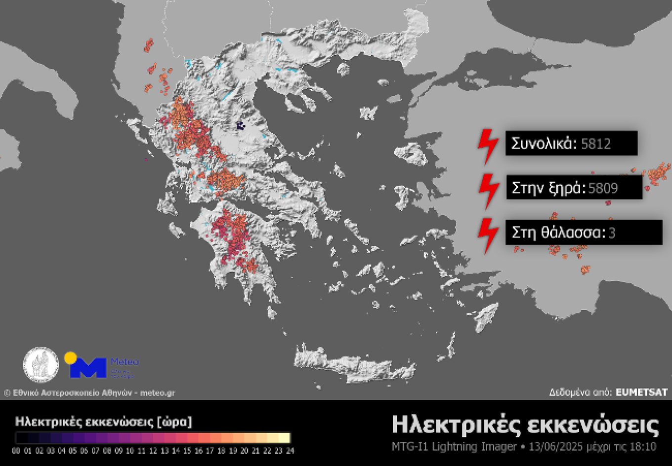
Nearly 6,000 Lightning Strikes Recorded on Friday, June 13
On June 13, local showers and thunderstorms primarily affected mountainous regions in Epirus, Western Central Greece, and the Peloponnese. Data from the third-generation European meteorological satellite Meteosat-12 and its Lightning Imager (LI) revealed nearly 6,000 lightning strikes by 18:10 on that day. This count includes cloud-to-ground strikes, intra-cloud discharges, and interactions between clouds and surrounding air.
Today’s Weather Outlook
The forecast indicates mostly clear skies, with local showers and thunderstorms developing during the midday and afternoon, particularly over the Peloponnese, Eastern Macedonia, and Thrace mountainous regions.
Temperature ranges are as follows:
- Western Macedonia: 12 to 29-30°C
- The rest of Macedonia and Thrace: 13 to 32-34°C
- Thessaly: 12 to 33°C
- Epirus: 12 to 33°C
- Other mainland areas: 13 to 33-35°C
- Ionian Islands: 16 to 32°C
- Aegean Islands and Crete: 15 to 32-34°C (locally reaching up to 35-36°C in Rhodes and Crete)
In the Aegean, winds will predominantly come from the north at 5-6 Beaufort, locally reaching 7 Beaufort in the southeastern Aegean. In the Ionian, northwesterly winds will be at 4-5 Beaufort.
In Attica, clear weather is anticipated. Winds will be from the north at 3-4 Beaufort, with localized gusts up to 5 Beaufort in eastern areas. Temperatures will range from 24 to 32-33°C.
In Thessaloniki, clear weather is also expected with winds from various directions at 2-3 Beaufort. Temperature ranges will be from 23 to 32-33°C.
Weather for Sunday, June 15
Expect generally clear skies, though clouds may form in some mainland areas during midday and afternoon, possibly leading to local showers in the western and northern mountainous regions.
Winds will be light and variable in the west, while in the east, expect northerly winds at 4 to 6 Beaufort, and up to 7 to 8 Beaufort in the eastern Aegean.
Temperatures are projected to slightly decrease, reaching 30-32°C in mainland areas, 28-30°C in the Ionian Islands, southern Crete, and Dodecanese, and 26-28°C in other island regions.
Weather for Monday, June 16
Expect generally clear conditions, with a few temporary clouds possibly appearing in some mainland areas during midday and afternoon. Local showers may occur in western and northern mountainous regions, and visibility could be reduced in the west during early morning hours.
Winds will be light and variable in the west, while in the east, expect northerly winds at 4 to 5 Beaufort, with southeastern Aegean gusts reaching 6 to 7 Beaufort.
Temperatures are expected to remain relatively stable.
Ask me anything
Explore related questions


