


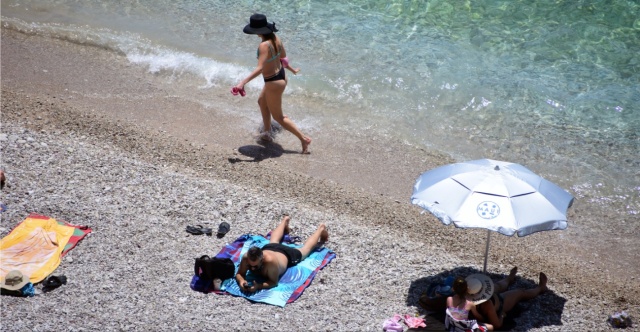
Rain will persist in many regions through Saturday until the evening. However, by Sunday, it appears that the unpredictable weather conditions will subside, leading to a slow increase in temperature at the start of the week. Starting Wednesday (June 4), the heat will intensify, with temperatures projected to reach around 32–35°C on the mainland. This prediction comes from Alpha TV meteorologist Giorgos Tsatrafilias, who referenced an “African anticyclone” that could push temperatures as high as 38°C.
Disagreement Among Meteorologists on the Term “African Anticyclone”
While there is consensus among meteorologists that the weather will change next week and temperatures will increase, there is some disagreement on the terminology used to communicate these changes to the public.
The latest contention arose when Alpha’s meteorologist Giorgos Tsatrafilias used the term “African anticyclone.” Theodoros Kolydas, former director of the Hellenic National Meteorological Service (EMY), responded that “no such scientific term exists.”
Tsatrafilias’ Statement
In his update regarding the weather shift starting Sunday, which could bring temperatures around 38°C, Tsatrafilias stated, “The Ionian Sea will start the week under distinctly summer-like conditions, influenced by anticyclonic conditions expected over the eastern Mediterranean, allowing heat to transfer from Africa.”
He indicated that the hottest days would be from Wednesday to Friday, with temperatures in Central Macedonia, Thessaly, Boeotia, Phthiotis, and the Peloponnese reaching 37–38°C, while Athens and Thessaloniki may experience temperatures of 35–36°C.
Kolydas’ Response
Shortly thereafter, Kolydas responded in a post on X (formerly Twitter), remarking that the term “African anticyclone” is merely a “media expression used to describe heat.”
He explained that the phrase “lacks meteorological precision. There is no defined term ‘African Anticyclone’ in scientific literature.” Kolydas elaborated that in everyday speech, the term refers to “a broad high-pressure system from North Africa (like the Sahara), characterized by warm air masses, dry southerly winds, and African dust.”
Kolydas added that “today’s instability will affect several regions, albeit less extensively, while Saturday’s weather will also be more subdued. From Sunday onward, stability will return.” He noted that temperatures would remain normal through Sunday, gradually rising by mid-next week, predicting temperatures about 4°C above the seasonal average.
Today’s Weather
Showers and thunderstorms are expected initially in Central Macedonia, Eastern Thessaly, Sterea, the Dodecanese, and Crete. These conditions will gradually extend to other parts of the country. Hail is possible on the mainland from noon until early evening. By day’s end, conditions will significantly improve, particularly in Central and Eastern Macedonia and possibly Crete.
Temperatures will range from 10 to 21°C in Western Macedonia, 15 to 27°C in the rest of Macedonia and Thrace, 16 to 27°C in Thessaly, 14 to 29°C in Epirus, 15 to 26°C in Central Greece, 13 to 28°C in the Peloponnese, 15 to 26°C in the Ionian Islands, 14 to 27°C in the North and East Aegean Islands, 17 to 23°C in the Cyclades, 16 to 21°C in the Dodecanese, and 15 to 25°C in Crete.
In the Aegean Sea, winds will blow from the north at 4 to 6 Beaufort. In the Ionian Sea, winds will come from the east at 3 to 5 Beaufort, shifting to northern directions of similar intensity by morning.
In Attica, clouds are expected with occasional rain, mainly in the northern part of the prefecture. Winds will be from the north at 3 to 5 Beaufort, with temperatures in central Athens ranging from 16 to 26°C.
In Thessaloniki, rain and potential thunderstorms are predicted. Winds will vary up to 3 Beaufort, with temperatures in central Thessaloniki reaching 17 to 26°C.
The Weather on Sunday 01-06-2025
In Crete, expect cloudy conditions with local rain and isolated thunderstorms until noon. The rest of the country will be partly cloudy, becoming thicker in the midday to afternoon hours over the mainland, bringing local rain and isolated thunderstorms, particularly in the central and southern mountains.
Winds in the west will vary from 3 to 4 Beaufort, while in the east, north winds at 3 to 5 Beaufort and locally 6 Beaufort will prevail in the Aegean Sea.
Temperatures will remain relatively stable, peaking at 24 to 26°C in the Ionian Sea and most semi-peripheral areas, locally reaching 27 to 28°C, and 23 to 25°C in the eastern islands.
The Weather on Monday 02-06-2025
Overall, clear weather is expected with occasional clouds developing in the midday to afternoon hours on the mainland, leading to localized rain mainly in the mountains.
Winds will blow from the west-northwest at 3 to 4 Beaufort, reaching 5 to 6 Beaufort in the eastern Aegean Sea.
Temperatures are projected to rise slightly.
The Weather on Tuesday 03-06-2025
Expect generally clear weather with some local clouds in the midday to afternoon hours on the mainland, with a possibility of local rainfall in the mountains of Epirus.
Winds will be from the west-northwest at 3 to 4 Beaufort, and in the central and southern Aegean Sea, they may reach 5 to 6 Beaufort.
Temperatures are anticipated to increase further.
Ask Me Anything
Explore Related Questions


