Turkey is asserting its position by submitting its own maritime maps to the appropriate UNESCO agency in response to Greece’s recent completion of the first phase of its maritime spatial planning. This marks Greece’s first official step toward organizing human activities in the marine environment—an initiative Athens plans to present to the United Nations soon.
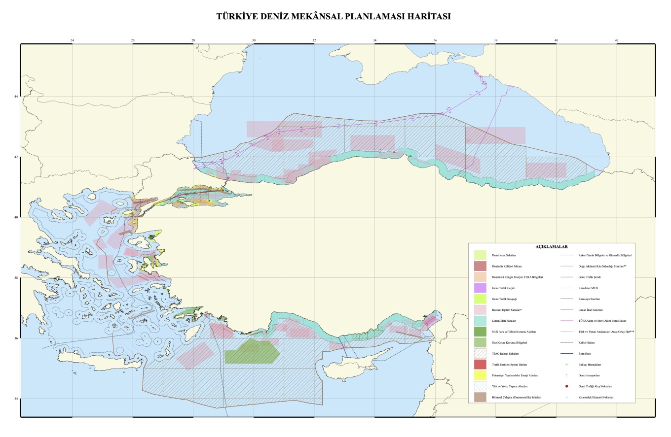
The Turkish maps embody Ankara’s well-documented revisionist approach, which contests the legal status of the Greek islands and supports its “median line” theory between Turkey and mainland Greece. The notable red line on the map begins at the Evros River’s mouth and stretches across the northern and southern Dodecanese, disregarding the continental shelf of the islands and acknowledging only their 6-nautical-mile territorial seas.
Overview of the Turkish Map
Created by Ankara University, the map was officially presented to UNESCO as a “scientific” document. In its southeastern section, which covers the Eastern Mediterranean, diagonal lines indicate offshore blocks designated for exploration by the Turkish Petroleum Corporation (TPAO). These areas coincide with Greece’s maritime claims and are connected to the “Blue Homeland” doctrine.
Additionally, Ankara unilaterally marked permanent military training zones in pink.
A significant feature is a black line that traverses international waters north of Crete and continues to the Dardanelles, referred to as a “cable” on the Turkish maps, although its purpose and specifics remain unexplained.
View the Map:

Response to Greece’s Initiative
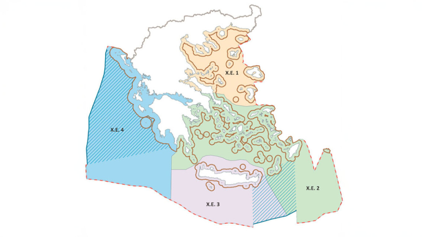
Greece’s introduction of its maritime spatial planning project has provoked strong reactions from Turkey. For the first time, Greece has delineated the geographical boundaries for its activities in the marine environment—a development firmly rooted in European and international law, representing a significant assertion of national sovereignty.
View the Greek Map:

Ask Me Anything
Explore Related Questions


