


Crete has been affected by heavy dust concentrations and extreme winds, experiencing the highest temperatures, strongest winds, and peak dust levels of any region. According to the National Observatory of Athens and meteo.gr, wind gusts surpassed 100 km/h in Rethymno and Lasithi, peaking at 137 km/h in Finokalia, Lasithi. Airborne particle levels reached nearly 1000 micrograms per cubic meter, marking this as one of the most significant dust transport events in recent years. A photograph from Rethymno showcases these high dust concentrations, along with a table detailing the eight strongest wind gusts recorded on Friday.
Air Quality Measurements: The air quality monitoring station at Rethymno Town Hall recorded dust concentrations close to 980 micrograms/m³ on Friday, while the station in Adeli reported levels near 984 micrograms/m³, both reflecting extremely high dust concentrations. Similar conditions were noted in Pyrgos and the broader Ilia area.
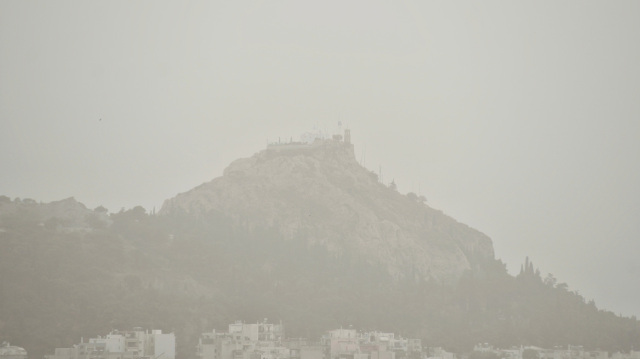
Images from Various Locations: Rethymno, Pyrgos, Ilia, Kyparissia in Messinia, Patras, and Volos all reported severely reduced visibility and compromised air quality due to the dust cloud.
Weather Outlook for Saturday (as per EMY): In northern Greece (Eastern Macedonia, Thrace, and the Aegean islands), expect showers and thunderstorms, some of which may be intense in the north during the morning with improvement by evening. Mainland Greece will see sparse clouds and isolated showers mostly in the afternoon. Winds will primarily come from the west at 3-5 Beaufort, locally gusting up to 6 over the seas. Temperatures are anticipated to decrease slightly in the south but rise marginally in the north, with maximum temperatures ranging from 22-23°C in the north, 22-24°C elsewhere, and up to 25°C in mainland regions and Crete.
Regional Forecasts:
Macedonia & Thrace: Expect cloudy skies with showers and thunderstorms, particularly strong in the morning; conditions will improve later. Winds from the west at 3-5 Bft. Temperature range: 11-22°C.
Ionian Islands, Epirus, Western Central Greece, Western Peloponnese: Partly cloudy with possible brief showers. Winds west-northwest at 3-4 Bft, locally reaching up to 5 in the morning. Temperatures will vary from 13-23°C.
Eastern Central Greece, Evia, Eastern Peloponnese: Similar conditions, with scattered clouds and the chance of afternoon showers. Winds from the west-northwest at 3-5 Bft, locally up to 6 in the south. Temperatures will range from 13-25°C.
Cyclades & Crete: Predominantly clear skies, though light rain may occur in Crete. Winds will be from the west-southwest at 4-6 Bft. Temperatures will be between 15-25°C.
Eastern Aegean & Dodecanese: Cloudy with localized showers and thunderstorms, particularly in Lemnos during the morning, gradually improving in the afternoon. Winds from the south-southwest at 5-6 Bft, shifting to west-southwest 3-5 Bft. Temperatures will range from 16-24°C, slightly cooler in the north.
Thessaly: Few clouds with the potential for afternoon showers. Winds from the west-northwest at 3-5 Bft, easing later. Temperatures will be between 10-23°C.
Attica: Mostly clear with few clouds. Winds from the west-northwest at 3-5 Bft. Temperatures will range from 12-24°C.
Thessaloniki: Occasional clouds that will gradually clear. Winds from the north-northwest at 4-5 Bft, weakening. Temperatures will range from 13-22°C.
Ask me anything
Explore related questions


